28 Sep 2022
Going Under Ground! Plantworx reveals what’s underground for its 2023 show
)
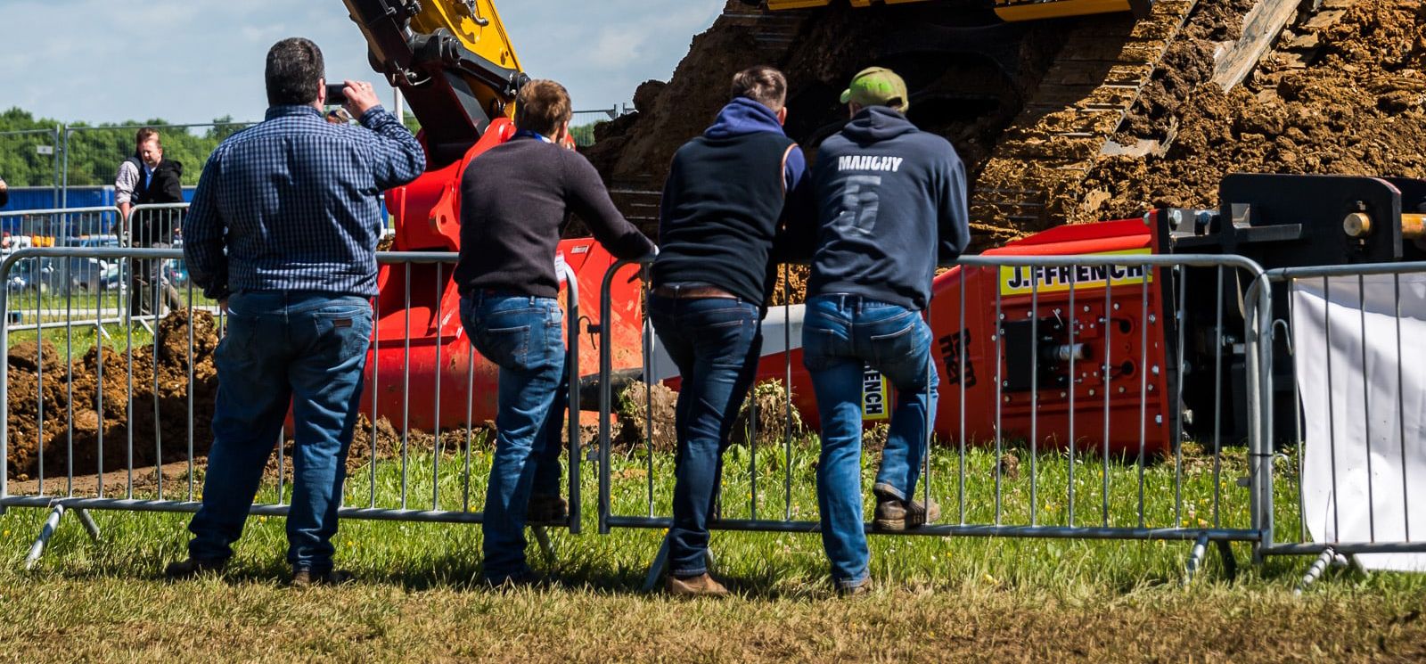
Even though the weather at the last Plantworx event in 2019 was challenging thousands of visitors made the pilgrimage to the event which proved to be a great success. This was thanks in part to its move to the East of England Showground, with its permanent walkways and a much-improved infrastructure for visitors. But for a few exhibitors, it was this very infrastructure that caused a few issues, as demonstration equipment buckets ruptured water pipes and unearthed cables. But according to site records, these utilities shouldn’t have been where they were digging. It might have been fun for the ducks when a hole became a pond, thanks to a water main strike, but it certainly wasn’t for the exhibitor. Although these incidents didn’t cause any major problems for the Plantworx team, headed by event director, Simon Frere-Cook MBE, they were enough to put a very different plan in motion to ensure they never happened again. This involved the commissioning of a ‘whole site’ survey with MK Surveys, who used Leica Geosystems ground penetrating radar and cable detection surveying equipment, to reveal just what was underground and where. The project itself took a team of three surveyors over two weeks to complete before all the information was then put into a 2D and 3D model. Talking to Simon at the showground, he explained why his team was ‘going underground’ and how the survey was going to allow them to change the next Plantworx show. (13th -15th June 2023, East of England Showground and Arena, Peterborough). Simon explained, “When we made the move to East of England showground, the first thing we needed to do was determine how we could put on the type of Plantworx show that visitors expect. The main part of this, of course, involves seeing plant and equipment in action, in our dig zones. In order to create that live dig area experience that everyone enjoys, we looked at the site plans and determined the best location for these activities to take place.  With the plans showing where the underground utilities were on the site, we decided to locate the dig zone into one area that was free from any of these pipes or cables. Of course, what we discovered at the show was the site plans were not up to date or accurate. We also recognised that concentrating all of the live demos into one area was not ideal for the way in which people visited the show.” Simon continued, “This was because the flow of visitors tended to focus on these areas. So, following a review of the 2019 show, we wanted to change this and of course avoid any potential incidents in the future, by investigating what was actually underground and where. In doing this we knew we could use the information to reshape the show, by opening up areas for demonstrations and distributing them more widely around the showground. This in turn would help us to improve the experience for visitors and exhibitors alike.” In order to build a factual and accurate underground model, the MK Surveys team brought a suite of Leica Geosystems surveying equipment onsite. In order to build a factual and accurate underground model, the MK Surveys team brought a suite of Leica Geosystems surveying equipment onsite, gathering information to be used to complete a comprehensive survey of the whole showground. The MK Surveys team, headed by Gordon Livie explained what was involved in the survey, how the equipment actually worked and what was involved with creating the final model. Gordon and his team worked with a range of Leica Geosystems equipment in a grid formation on a grassed area that makes up part of the 250 acres of outside space at the showground. Gordon said, “Before we even got to site with our equipment, we had to do a lot of research to collate and study the existing plans of the site, which would give us a guide of what to expect. This process included collecting plans from the East of England showground and the statutory undertakers”. “On looking at the plans, it became clear that over time, they had been altered with various degrees of accuracy, from pencilled in lines to more detailed drawings. But as we got onto site surveying, we soon learnt that although these documents showed some of the utilities, there were many more hidden below ground that hadn’t made it onto the plans.” “Of course, the problem comes with this type of site when you have both historic utilities like metal pipework and then newer utilities like plastic pipes. This is because the standard metal detection systems you can use, don’t work with plastic utilities. In order to ensure we captured everything accurately, we had to combine the use of the Leica Ultra Electromagnetic Locator metal detection system, its smaller Leica DS2000 Ground Penetrating Radar and its larger cousin, the Leica Stream C Ground Penetrating Radar.” “In order to create the site model, we used all of the detection equipment to detect the underground utilities first. Then all location equipment was used to map the positions of the detected utilities. All the ground penetrating radar (GPR) data was then collected using GNSS tracking, so the positions of any utilities were recorded in the exact location as we carried out the survey.” “For anyone not familiar with how GPR equipment works, basically the technology uses a transmitter and antennas which emit electromagnetic energy into the ground. When the energy encounters a buried object or a boundary between materials the receiving antenna is able to process this and create a model by recording the variations in the return signal. So, if a plastic pipe or other utility is in the ground, this will show up on the readings. This means we are able to collect accurate depth, and size information of the utilities, that is then put together by our software modelling experts. This, in turn, allows them to build an accurate model of what is underground, creating a 2D and 3D version of this.” Gordon described what the team discovered after the survey was finished, he had some quite startling revelations, with some utilities up to 10 metres in the “wrong” location. The large fuel main which crosses the site has also now been properly mapped as the location of this was a very grey area. Gordon assured the Plantworx team that any areas proposed to be excavated would be cleared before any ground is broken for the 2023 event. After all, with almost four years passing between the survey and the event, due to the COVID pandemic and cancelling the 2022 event, allowing Hillhead to go ahead, there is no telling if a new utility has been installed that was not picked up this time. Stand sales for the 2023 Plantworx event are going great guns with many leading OEMs, suppliers and innovators already signed up to exhibit at the show – please contact Angela Spink, Plantworx sales manager angela.spink@plantworx.co.uk for further details. If you require digging demo space – please don’t delay as to date 65% of the digging demo areas are now sold. Visit www.plantworx.co.uk for further details…
With the plans showing where the underground utilities were on the site, we decided to locate the dig zone into one area that was free from any of these pipes or cables. Of course, what we discovered at the show was the site plans were not up to date or accurate. We also recognised that concentrating all of the live demos into one area was not ideal for the way in which people visited the show.” Simon continued, “This was because the flow of visitors tended to focus on these areas. So, following a review of the 2019 show, we wanted to change this and of course avoid any potential incidents in the future, by investigating what was actually underground and where. In doing this we knew we could use the information to reshape the show, by opening up areas for demonstrations and distributing them more widely around the showground. This in turn would help us to improve the experience for visitors and exhibitors alike.” In order to build a factual and accurate underground model, the MK Surveys team brought a suite of Leica Geosystems surveying equipment onsite. In order to build a factual and accurate underground model, the MK Surveys team brought a suite of Leica Geosystems surveying equipment onsite, gathering information to be used to complete a comprehensive survey of the whole showground. The MK Surveys team, headed by Gordon Livie explained what was involved in the survey, how the equipment actually worked and what was involved with creating the final model. Gordon and his team worked with a range of Leica Geosystems equipment in a grid formation on a grassed area that makes up part of the 250 acres of outside space at the showground. Gordon said, “Before we even got to site with our equipment, we had to do a lot of research to collate and study the existing plans of the site, which would give us a guide of what to expect. This process included collecting plans from the East of England showground and the statutory undertakers”. “On looking at the plans, it became clear that over time, they had been altered with various degrees of accuracy, from pencilled in lines to more detailed drawings. But as we got onto site surveying, we soon learnt that although these documents showed some of the utilities, there were many more hidden below ground that hadn’t made it onto the plans.” “Of course, the problem comes with this type of site when you have both historic utilities like metal pipework and then newer utilities like plastic pipes. This is because the standard metal detection systems you can use, don’t work with plastic utilities. In order to ensure we captured everything accurately, we had to combine the use of the Leica Ultra Electromagnetic Locator metal detection system, its smaller Leica DS2000 Ground Penetrating Radar and its larger cousin, the Leica Stream C Ground Penetrating Radar.” “In order to create the site model, we used all of the detection equipment to detect the underground utilities first. Then all location equipment was used to map the positions of the detected utilities. All the ground penetrating radar (GPR) data was then collected using GNSS tracking, so the positions of any utilities were recorded in the exact location as we carried out the survey.” “For anyone not familiar with how GPR equipment works, basically the technology uses a transmitter and antennas which emit electromagnetic energy into the ground. When the energy encounters a buried object or a boundary between materials the receiving antenna is able to process this and create a model by recording the variations in the return signal. So, if a plastic pipe or other utility is in the ground, this will show up on the readings. This means we are able to collect accurate depth, and size information of the utilities, that is then put together by our software modelling experts. This, in turn, allows them to build an accurate model of what is underground, creating a 2D and 3D version of this.” Gordon described what the team discovered after the survey was finished, he had some quite startling revelations, with some utilities up to 10 metres in the “wrong” location. The large fuel main which crosses the site has also now been properly mapped as the location of this was a very grey area. Gordon assured the Plantworx team that any areas proposed to be excavated would be cleared before any ground is broken for the 2023 event. After all, with almost four years passing between the survey and the event, due to the COVID pandemic and cancelling the 2022 event, allowing Hillhead to go ahead, there is no telling if a new utility has been installed that was not picked up this time. Stand sales for the 2023 Plantworx event are going great guns with many leading OEMs, suppliers and innovators already signed up to exhibit at the show – please contact Angela Spink, Plantworx sales manager angela.spink@plantworx.co.uk for further details. If you require digging demo space – please don’t delay as to date 65% of the digging demo areas are now sold. Visit www.plantworx.co.uk for further details…